August 2022
Here is our August map of killer whale sightings in the Salish Sea!
While the Southern Residents were only present during the first two weeks of the month, everyone but the L54 sub-group paid a visit. Coming down Rosario Strait after a trip to the Fraser River used to be commonplace, but taking that route has fallen out of fashion in recent years. Both Ls and Js did, however, take Rosario southbound last month.
In the northern reaches of the Salish Sea, the A23s and A54s made one brief foray into Nodales Channel, but otherwise stayed in Johnstone Strait or further north.
And Bigg's killer whales continue to be a big story, confirmed present every single day in August. The number of members of the population identified in the Salish Sea in August was actually down compared to previous months (at least 95 different whales compared to 120+ in other recent months), but many whales who did make an appearance spent a lot of time here. Some examples included the T124A2s and T124A4s, T36 and the T36Bs, the T137s, and the T65As and T77s.
September has thus far been the one month where Southern Resident presence in the Salish Sea has remained at historic levels, and they did not disappoint, with J-Pod returning after a 2.5 week absence on September 1. We can't wait to to see how the rest of the month shapes up.
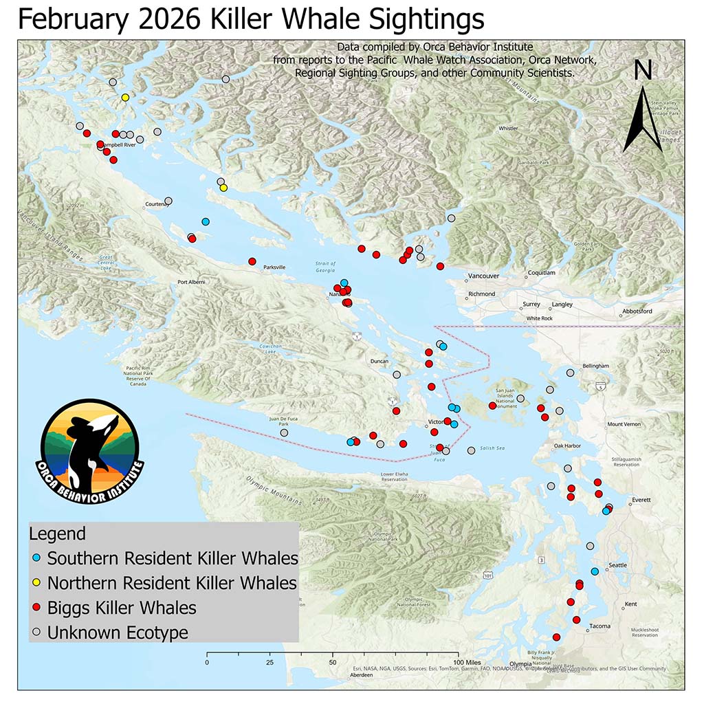
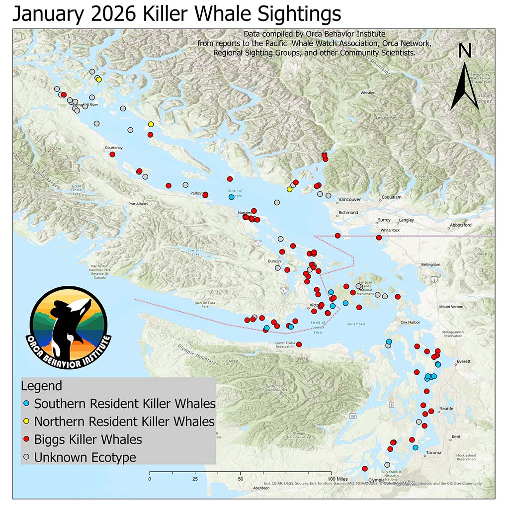
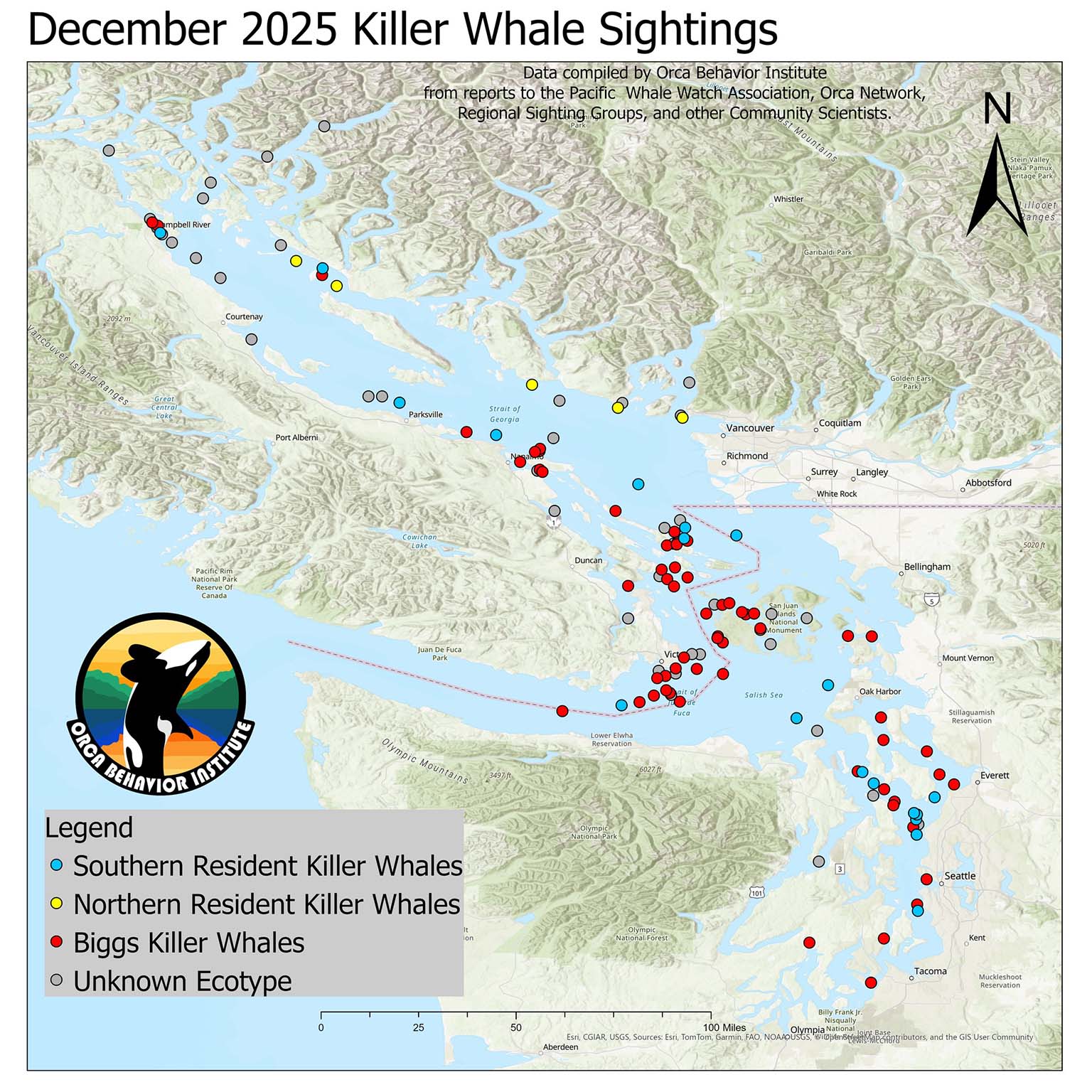
Note on reading the map: Each dot represents the first location of a unique sighting of a group of whales on a given day, so this doesn't represent everywhere the whales traveled; instead it gives an overall sense of the number of unique whale sightings for the month. This time of year, with a lot more eyes on the water, we get a lot more in the way of documentation and IDs, but the few gray dots indicate "unknown ecotype", meaning killer whales were confirmed but it was not possible to confirm specific whale IDs.